
As the Pacific Ocean churns with renewed ferocity, Typhoon Bavi has emerged as a formidable threat to East Asia, prompting widespread evacuations and emergency preparations across Taiwan, China, and Japan. With its massive physical footprint and intensifying wind speeds, the storm is being scrutinized by international meteorologists as a potential benchmark for extreme weather in 2026. Authorities are currently racing against the clock to mitigate the impact of a system that threatens to be the largest, by size, to strike the region in nearly four decades.
Main Facts: A Storm of Unprecedented Scale
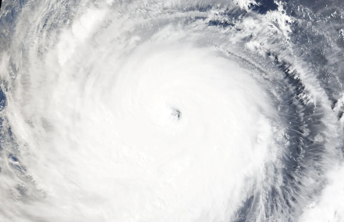
Typhoon Bavi, currently situated southeast of Taiwan, has sent shockwaves through the regional meteorological community. On Thursday, the storm maintained wind speeds just shy of 200 kph. Its most defining characteristic, however, is not just its intensity, but its sheer physical size. Spanning approximately 1,000 kilometers at its widest point—a distance roughly equivalent to the width of France—Bavi represents a rare and dangerous meteorological phenomenon.
Jason Chang, a senior forecaster with Taiwan’s Central Weather Administration, noted that Bavi is set to be the largest storm to affect Taiwan since 1987. "Storms of this massive physical magnitude have been fairly rare in recent years," Chang remarked, emphasizing the danger posed by a system that covers such a vast geographic area. The storm’s slow, deliberate movement over the warm waters of the Pacific has allowed it to "feed," accumulating significant moisture and latent heat, which experts warn will likely result in catastrophic rainfall and storm surges upon landfall.
Chronology: The Path of the Behemoth
The trajectory of Typhoon Bavi is being tracked with intense precision. Having spent several days gathering strength over the open Pacific, the storm is currently on a path to skirt northern Taiwan. Forecasters predict that it will maintain its current trajectory through Friday, with landfall projected for China’s eastern Fujian province by Saturday evening.
- Early Thursday: Bavi maintains wind speeds near 200 kph, with the eye moving northwest.
- Friday: The outer bands of the storm begin to impact coastal Taiwan and Japan’s Okinawa prefecture. Flight cancellations begin to mount.
- Saturday Morning: The storm is expected to intensify its proximity to the Fujian coastline.
- Saturday Evening: Projected landfall in eastern China, with significant inland penetration expected throughout Sunday and Monday.
AccuWeather international forecasting expert Jason Nicholls has cautioned that while some slight loss of wind intensity may occur as the storm encounters cooler coastal waters, Bavi will remain a "dangerous, destructive system" as it moves from Taiwan through to the Chinese mainland.
Supporting Data: Climate Change and the "El Niño" Factor
The increasing frequency of such powerful storms is no longer considered an anomaly by the scientific community. There is a broad consensus among climatologists that climate change is playing a direct role in the intensification of Pacific typhoons.
Xiangbo Feng, a research scientist specializing in tropical cyclones at Imperial College London, points to the storm’s long duration over open water as a critical factor. "Bavi has spent a long time intensifying, extracting energy from the warm ocean and accumulating massive amounts of moisture," Feng explained. "When it finally makes landfall, the potential for damage is exponential. Even a minor deviation in its track could mean the difference between a glancing blow and a catastrophic direct hit on high-density urban areas."
Furthermore, the expected emergence of an El Niño pattern in 2026 is of significant concern. El Niño conditions are known to drive up sea-surface temperatures in the Pacific, providing the "fuel" necessary for storms to reach higher intensity levels more rapidly. If Bavi holds its current forecast intensity, it will stand as the most powerful typhoon to hit the region since Super Typhoon Kong-rey in 2024, marking a worrying trend of back-to-back extreme weather events.
Official Responses: Bracing for Impact
Across the affected territories, governments have moved into high-alert status. In Taiwan, the response has been both systemic and urgent. In the northeastern port of Suao, hundreds of fishing vessels have been tightly moored, creating a dense mosaic of hulls in the harbor. Local authorities have been distributing sandbags to residents, while farmers are scrambling to harvest rice crops before the gale-force winds arrive.
In Japan, the meteorological agency has issued urgent warnings for the Okinawa prefecture, specifically highlighting the risks of violent winds, landslides, and storm surges. The economic impact is already being felt; Japan Airlines confirmed the cancellation of 48 domestic flights scheduled for Friday, a move affecting over 7,600 passengers.
In China, the response is compounded by the trauma of recent events. The nation is still reeling from the aftermath of Typhoon Maysak, which caused widespread destruction across the Guangxi region and sparked inland tornadoes in Hubei. The scale of the recovery effort has been massive, and local governments are now struggling to pivot their emergency services to address the approaching threat of Bavi.
Implications: A Lesson from the Recent Past
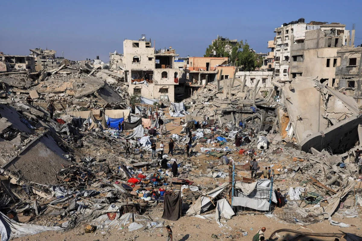
The devastation wrought by Typhoon Maysak serves as a grim preview of what Bavi might bring. The incident at the Guigang Zoo in China has become a focal point for the conversation regarding the secondary impacts of these storms. During the flooding caused by Maysak, over 100 animals escaped, including zebras, porcupines, and various species of parrots.
The tragedy of the zoo—where three lions were lost to floodwaters and others, including brown bears and wolves, were left in critical condition—underscores the unpredictability of storm-induced disasters. It serves as a reminder that the impact of a typhoon extends far beyond structural damage to homes and power grids; it disrupts the entirety of the local ecosystem and human infrastructure.
The Human Element: "Don’t Be Fooled"
For those living in the direct path of the storm, the technical data often takes a backseat to the lived experience of survival. Chen Ming-hui, a 60-year-old captain in Suao, represents the resilient but weary face of those who live at the mercy of the Pacific.
"Don’t be fooled by the nice and calm weather now," Chen said, his hands calloused from years of securing his vessel against the sea. "A storm like this could be the most terrifying. It is the ones that feel slow and heavy that tear everything apart."
As the horizon darkens and the barometric pressure drops, the communities in the path of Bavi are not merely waiting; they are actively fortifying their lives. The coming 72 hours will test the efficacy of modern disaster preparedness, the integrity of regional infrastructure, and the resolve of the millions of people who stand in the shadow of this massive, swirling atmospheric giant.
As the world watches, the overarching question remains: is the region equipped to handle a future where "once-in-a-generation" storms are becoming a seasonal reality? For now, the priority is clear—shelter, prepare, and survive.
© Thomson Reuters 2026.