
As the summer of 2026 descends upon the Northern Hemisphere, the skies over North America have once again turned a hazy, apocalyptic orange. Millions of residents from the Canadian boreal forests to the American Midwest are navigating a new, suffocating reality characterized by record-breaking wildfire activity. Yet, amidst the smoke and the chaos, a technological breakthrough has reached orbit: the first three operational satellites of the Google-backed FireSat constellation.
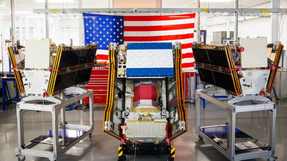
This launch, which took place on July 7, 2026, from Vandenberg Space Force Base, represents more than just a successful SpaceX mission; it marks a pivotal shift in humanity’s ability to monitor, predict, and combat the escalating climate crisis. By providing high-resolution, near-real-time data on active fires, the FireSat program aims to close the critical "detection gap" that has long allowed small blazes to mushroom into uncontrollable infernos.
The Genesis of FireSat: A Technological Pivot
FireSat is not merely another remote-sensing mission. Managed by the non-profit Earth Fire Alliance and designed by the Silicon Valley-based satellite manufacturer Muon Space, the constellation was built with a singular, mission-critical purpose: to see what other satellites cannot.
Traditional weather and Earth-observation satellites often rely on sensors designed for broad climate monitoring, which can be blind to the specific heat signatures of smaller, early-stage wildfires. Furthermore, heavy smoke plumes frequently obscure the view of standard optical cameras. FireSat addresses this by utilizing advanced multispectral imaging capable of "peering through" thick smoke and clouds.
The technology has already proven its mettle. A "Protoflight" satellite, launched in March 2025, served as the proof of concept. Over the course of its testing, it captured more than one million images, demonstrating a sensitivity capable of detecting fires as small as five by five meters—roughly the size of a standard backyard shed.

A Chronology of Deployment
The road to this initial operational capability has been rapid and heavily incentivized by private capital.
- March 2025: The FireSat Protoflight satellite is deployed, validating the multispectral imaging technology and demonstrating its ability to distinguish between active flames, fresh burn scars, and cooling embers.
- Late 2025: Google announces a $15 million investment to accelerate the development of the operational constellation, signaling a deepened commitment to using AI for climate resilience.
- Early 2026: The Bezos Earth Fund pledges $26 million, highlighting the international urgency of the project.
- July 7, 2026: The first three operational FireSat microsatellites are successfully launched into low-Earth orbit via a SpaceX Falcon 9 rocket.
- October 2026 (Projected): Following a three-month calibration and testing phase, these three satellites will begin delivering operational data to partner agencies in California, Colorado, Australia, and Portugal.
- 2029–2030s: The constellation aims to scale to over 50 satellites, eventually providing global imagery of fire-prone regions at 20-minute intervals.
The Power of Data: How FireSat Changes the Equation
The current wildfire management paradigm is often reactive. By the time a fire is identified via satellite, human lookout towers, or 911 calls, it has often grown beyond the capacity of initial suppression teams. FireSat changes this by offering an "early adopter" advantage.
By providing data to agencies on an hourly basis—and eventually every 20 minutes—the system allows for "precision firefighting." If a fire is detected at the five-meter mark, ground crews or aerial tankers can be dispatched while the blaze is still in its infancy. The Earth Fire Alliance estimates that this increased revisit rate could save upwards of $1 billion in property damage, protect over 3,500 homes, and prevent nearly 22 million tons of carbon emissions that would otherwise be released by uncontrolled, high-intensity forest fires.
Beyond raw imagery, Google Research is integrating the system with advanced AI models. These models compare incoming FireSat data against historical burn patterns and vegetation health maps, allowing for predictive modeling that identifies not just where a fire is, but where the "highest risk" zones are currently primed to ignite.
The Dual-Edged Sword: AI and Climate Paradox
The celebration of FireSat’s launch is tempered by a sobering irony. While Google and its partners utilize AI to fight the symptoms of climate change—wildfires—the company is simultaneously facing scrutiny for the climate costs associated with the AI boom itself.

The energy demands of massive AI data centers have driven a significant surge in electricity consumption. In 2025 alone, Google’s own electricity usage jumped by 37 percent. Much of this power is still being drawn from grids that rely on natural gas, leading to a surge in greenhouse gas emissions that some analysts suggest could outpace the emissions of entire nations.
This creates a "climate feedback loop": the same technology used to monitor the destruction caused by global warming is, in part, contributing to the energy-intensive infrastructure that drives global warming. Google has acknowledged these challenges, stating they are working to offset these emissions through clean energy projects, but the tension between the "AI for Good" narrative and the "AI for Profit" infrastructure remains a point of contention for environmental watchdogs.
Managing the Unmanageable: The Crisis in the Boreal Forest
Regardless of the technological sophistication of FireSat, the fundamental issue remains: climate change is pushing global ecosystems past their breaking point. The 2026 wildfire season in Canada has been particularly brutal, with boreal forests burning with unprecedented intensity.
As retired research scientist Werner Kurz noted, the "old strategies of fire suppression" are being systematically overwhelmed. The sheer scale of the fires—nearly 900 active blazes in Canada as of mid-July 2026—means that many of these fires are deemed "unmanageable." Fire agencies are currently forced to triage, monitoring "out of control" fires from a distance while prioritizing the protection of human settlements and critical infrastructure.
In Canada, the struggle is compounded by resource constraints. While the federal government recently leased 10 new aerial firefighting aircraft to serve as a surge capacity for the provinces, the demand for such assets consistently outstrips supply. FireSat, in this context, becomes an essential tool for prioritization. If agencies know exactly where the most dangerous, high-intensity fronts are, they can deploy their limited, precious aviation assets where they will have the greatest impact.

Future Outlook: Scaling the Constellation
The vision for the early 2030s is a fully autonomous, global "nervous system" for wildfire detection. With a constellation of 50 satellites, the gaps in coverage will vanish.
However, technology alone cannot replace land management. Experts agree that while satellites like FireSat provide the "eyes" to see the problem, the "hands" needed to solve it—prescribed burns, forest thinning, and robust climate policy—are more necessary than ever.
"We are providing the data," says an Earth Fire Alliance spokesperson. "But the data is only as good as the policy that follows it."
As the world watches the smoke drift across borders, the success of FireSat will likely serve as a litmus test for the role of private-public partnerships in the climate era. If the constellation can truly help turn the tide on wildfire destruction, it may well become the gold standard for how global industries can pivot to address the most urgent environmental threats of the 21st century.
For now, the three satellites currently orbiting the planet are a beacon of hope, a small but vital technological shield against a warming world that is increasingly prone to catching fire.